
Sale!

Green Trails Map 205S – Rattlesnake Mountain
Original price was: $14.00.$8.82Current price is: $8.82.
- Experience the Best Quality
- 7 Days of Hassle-Free Returns
- Protecting Your Payment Information
- High quality products, low prices.

There are many hiking options just a short drive from Seattle. Green Trails Rattlesnake Mountain map (205S) leads from Rattlesnake Mountain to the Snoqualmie Valley in beautifully detailed topography.
Features
- Covers Rattlesnake Mountain Scenic Area, Rattlesnake Lake Recreation Area, Snoqualmie Ridge, Snoqualmie Falls and Snoqualmie Valley trails
- Green Trails Maps show the most current trail, road, and access information to national forests, national parks, state and local parks and other public lands
- Printed on waterproof and tear-resistant paper, this map withstands the rigors of adventures in less than ideal conditions
Made in USA.
Technical Specs
| Best Use | Hiking |
|---|---|
| Folded Dimensions | 9 x 6 inches |
| Unfolded Dimensions | 24 x 18 inches |
| Map Scale | 1:24,000 |
| Double Sided | Yes |
| Waterproof | Yes |
| Publisher | Green Trails Maps |
| Copyright Year | 2017 |
| State / Province | Washington |
| Map Number | 205S |
| Color | None |
|---|
Be the first to review “Green Trails Map 205S – Rattlesnake Mountain”
Related products
Sale!
Original price was: $22.95.$16.29Current price is: $16.29.
Sale!
Books and Maps
Original price was: $12.95.$8.81Current price is: $8.81.
Sale!
Original price was: $24.95.$15.72Current price is: $15.72.
Sale!
Original price was: $18.95.$13.83Current price is: $13.83.
Sale!

Original price was: $24.95.$14.97Current price is: $14.97.
Sale!
Books and Maps
Original price was: $12.95.$9.45Current price is: $9.45.
Sale!
Books and Maps
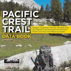
Wilderness Press Pacific Crest Trail Data Book – 6th Edition
Original price was: $12.95.$9.45Current price is: $9.45.
Sale!

Books and Maps
Original price was: $19.95.$12.17Current price is: $12.17.
Reviews
There are no reviews yet.